


KC WD1 PCT101, Jackson County, Missouri
About
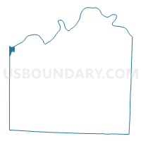
Outline

Summary
| Unique Area Identifier | 608229 |
| Name | KC WD1 PCT101 |
| County | Jackson County |
| State | Missouri |
| Area (square miles) | 1.16 |
| Land Area (square miles) | 1.08 |
| Water Area (square miles) | 0.08 |
| % of Land Area | 93.18 |
| % of Water Area | 6.82 |
| Latitude of the Internal Point | 39.10175340 |
| Longtitude of the Internal Point | -94.59920280 |
Maps


Graphs
Select a template below for downloading or customizing gragh for KC WD1 PCT101, Jackson County, Missouri


Neighbors
Neighoring Voting District (by Name) Neighboring Voting District on the Map
- Kansas City Ward 1 Precinct 01, Wyandotte County, KS
- Kansas City Ward 1 Precinct 03, Wyandotte County, KS
- Kansas City Ward 7 Precinct 01, Wyandotte County, KS
- KC 21-2 Voting District, Clay County, MO
- KC WD1 PCT102, Jackson County, MO
- KC WD1 PCT103, Jackson County, MO
- KC WD1 PCT104, Jackson County, MO
- KC WD1 PCT105, Jackson County, MO
- KC WD1 PCT106, Jackson County, MO
- KC WD1 PCT108, Jackson County, MO
Top 10 Neighboring County Subdivision (by Population) Neighboring County Subdivision on the Map
- Kaw township, Jackson County, MO (170,129)
- Kansas City city, Wyandotte County, KS (145,786)
- Gallatin township, Clay County, MO (68,393)
Top 10 Neighboring Place (by Population) Neighboring Place on the Map
Top 10 Neighboring Unified School District (by Population) Neighboring Unified School District on the Map
- Kansas City School District, MO (194,122)
- North Kansas City School District, MO (123,348)
- Kansas City Unified School District 500, KS (115,219)
Top 10 Neighboring State Legislative District Lower Chamber (by Population) Neighboring State Legislative District Lower Chamber on the Map
- State House District 31, MO (34,655)
- State House District 37, MO (33,162)
- State House District 40, MO (32,757)
- State House District 37, KS (21,850)
- State House District 32, KS (20,891)
- State House District 35, KS (20,403)
Top 10 Neighboring State Legislative District Upper Chamber (by Population) Neighboring State Legislative District Upper Chamber on the Map
- State Senate District 17, MO (199,316)
- State Senate District 10, MO (160,344)
- State Senate District 6, KS (66,722)
- State Senate District 4, KS (62,358)
Top 10 Neighboring 111th Congressional District (by Population) Neighboring 111th Congressional District on the Map
- Congressional District 3, KS (767,569)
- Congressional District 6, MO (693,974)
- Congressional District 5, MO (633,887)
Top 10 Neighboring Census Tract (by Population) Neighboring Census Tract on the Map
- Census Tract 221, Clay County, MO (4,283)
- Census Tract 153, Jackson County, MO (3,149)
- Census Tract 157, Jackson County, MO (1,886)
- Census Tract 152, Jackson County, MO (1,727)
- Census Tract 11, Jackson County, MO (1,709)
- Census Tract 158, Jackson County, MO (1,485)
- Census Tract 430, Wyandotte County, KS (82)
- Census Tract 400.02, Wyandotte County, KS (3)
- Census Tract 400.01, Wyandotte County, KS (0)
Top 10 Neighboring 5-Digit ZIP Code Tabulation Area (by Population) Neighboring 5-Digit ZIP Code Tabulation Area on the Map
- 64116, MO (15,318)
- 66103, KS (13,934)
- 64108, MO (7,584)
- 64105, MO (3,505)
- 64101, MO (339)
- 66118, KS (3)
- 66115, KS (0)
- 64102, MO (0)